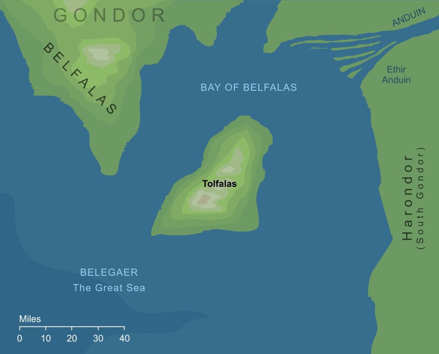
A small island of Gondor in the Bay of Belfalas, lying some forty miles out to Sea southwestward from the Mouths of Anduin. The isle was of an elongated shape, running some sixty miles from end to end along its greatest length. Its southern cape was considered the most southerly point in Gondor, and there at that southern extent the isle lay close to the peninsula of Belfalas, being no more than twenty-five miles offshore from that point. The coasts of Tolfalas were beaten by waves, and indeed its name means 'surf island'. From those shores its land rose to form heights in the central part of the island.
Tolfalas (whose name is occasionally spaced as Tol Falas) played little part in history. Indeed, while it appears on the maps accompanying The Lord of the Rings, it is not mentioned anywhere in the text of the book. We can glean a few further details about the island from additional sources, however. In particular, it was apparently once more fertile than it would later become, but the great waves caused by Downfall of Númenor washed it clean and left it standing in the ocean as a barren mountain.1
The shallow sound to the north of the island was treacherous for shipping, because of the shingles extending southward from the mouths of the river Serni. Vessels coming into Pelargir or the Harlond from the Great Sea, therefore, would sail around Tolfalas' eastern side, and then northward into Anduin, avoiding the shallows to the island's north.
In drafts of the story of the War of the Ring (mentioned in volume VIII of The History of Middle-earth) Tolfalas played a very small role in events, when the Haradrim landed there and captured the island. Although even this minor matter this was omitted from the final version, it does at least imply that there was something on the island worth capturing, in turn suggesting that it was not quite as barren as other accounts might imply.
Notes
1 |
The version of Tolfalas shown on maps seems very considerably larger than we might expect for a single mountain, unless it were a truly immense one. We might take this to suggest that the maps enlarge its dimensions, and that it was actually rather smaller than the length of about sixty miles implied by the standard scale.
|
Indexes:
About this entry:
- Updated 26 September 2026
- This entry is complete
For acknowledgements and references, see the Disclaimer & Bibliography page.
Original content © copyright Mark Fisher 1997-2026. All rights reserved. For conditions of reuse, see the Site FAQ.
 SHARE