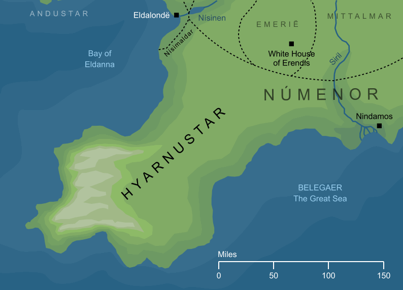
The Hyarnustar was one of the five promontories that reached out into the Great Sea around the isle of Númenor. It extended from the Inlands of the isle, called the Mittalmar, in a southwesterly direction, and its name is interpreted as the 'Southwestlands'. The entire region ran for approximately three hundred miles (or nearly five hundred kilometres) from its inner borders to its outer seaward extent. Its northwestern side was washed by the waters of the Bay of Eldanna, while its southeastern side formed part of the coasts of Númenor's long, wide southern bay.
The outer stretches of the Hyarnustar, where it reached farthest out into the Sea, were marked by rocky hills. Farther inland, where the peninsula joined with the central parts of Númenor, was a fertile lowland, especially noted for its vineyards. The eastern border of the Hyarnustar was formed in part by the river Siril which, as it approached its mouths, divided the Southwestlands of the Hyarnustar from the Southeastlands of the Hyarrostar, a similar great promontory that stretched away to the southeast.
The Hyarnustar played no important role in the recorded histories of Númenor, and so we know essentially nothing about the people who lived there, other than the fact that some of them kept vineyards or otherwise cultivated the land in its eastern parts. There were presumably cities and roads within the Hyarnustar as there were elsewhere in the realm, but they are not described in any surviving account, nor shown on any map.
Indexes:
About this entry:
- Updated 7 October 2026
- This entry is complete
For acknowledgements and references, see the Disclaimer & Bibliography page.
Original content © copyright Mark Fisher 1997-2026. All rights reserved. For conditions of reuse, see the Site FAQ.
 SHARE