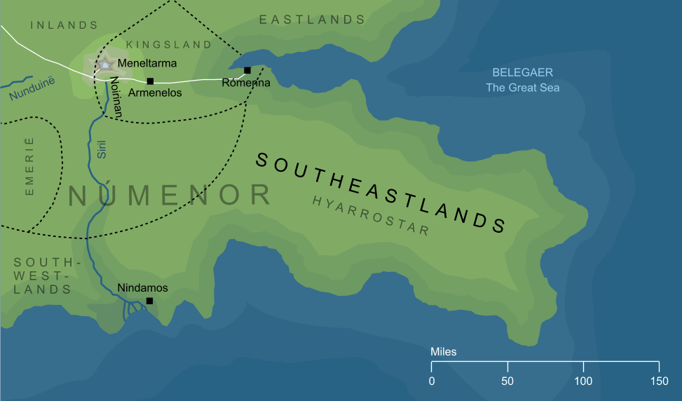
The island of Númenor had five great promontories extending out into the Great Sea, and each of these was named for the direction in which it lay from the central mass of the island. The southeastern of these was known as the Hyarrostar, translated as 'Southeastlands'. A wide, densely forested region, its western border, where it marched with the Hyarnustar or Southwestlands, was marked by the river Siril and the shoreland town of Nindamos. To the north, it was separated from the Orrostar (Eastlands) by a narrow inlet at whose head lay the great eastern haven of Rómenna.
 SHARE
SHARE